LK
IN-359
Featured
The Miami, Potawatomi, Lenape, and Shawnee held Indiana’s river valleys before the Northwest Ordinance brought American settlement north of the Ohio in 1787. Statehood arrived in 1816. Abraham Lincoln grew up in Spencer County between the ages of seven and twenty-one — the years that made him. The Indianapolis 500 has run every Memorial Day since 1911 on a track built from 3.2 million bricks. Cole Porter, Kurt Vonnegut, and the Jackson Five all came from here. Indiana is the crossroads, and nobody is neutral about it.
Indiana runs from the Lake Michigan shoreline in the northwest — where the Indiana Dunes rise above the steel mills of Gary — through the flat glaciated plains of the center to the hilly karst country of the south, where the Ohio River forms the border with Kentucky. Its 92 counties cover every landscape between the dunes and the river.
Begin with the territory that calls to you — your homeland, a frontier you love, or simply somewhere your story belongs.
Each hex is a sovereign coordinate. Pick a coastline, a valley, a city block — anywhere on the grid that resonates with your roots or your dream.
A photograph, a paragraph, a name. Your hex becomes a permanent thread in the larger national tapestry — the 250-year-old story of America, continued.
Your inscription becomes a permanent thread in the American story — and a keepsake you can print, frame, and hold.
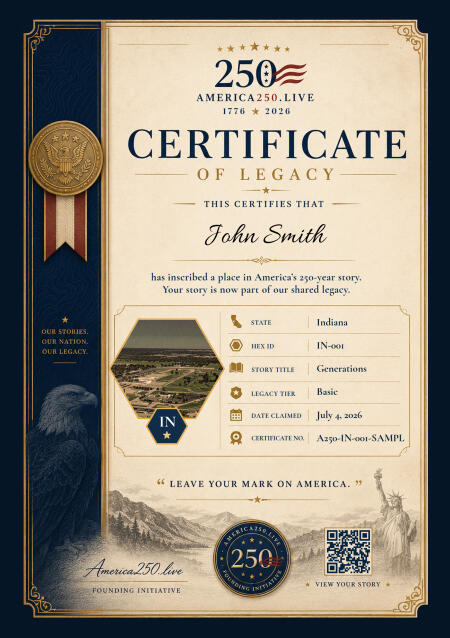
Your Commemorative Certificate
Print it. Frame it. Pass it down.
High-resolution digital certificate, custom to your state, delivered the moment your inscription is complete.
Digital Hex
Living Legacy
Your Inscription
$99 one-time · yours forever
Founder price, held through July 11. $199 afterward — and it stays there.
The Miami, Potawatomi, Lenape, Shawnee, and other nations inhabited Indiana’s river valleys and prairies for centuries before European contact. The Miami people in particular built a sophisticated confederation centered on the Wabash and Maumee rivers. French traders and missionaries arrived in the late seventeenth century, establishing Fort Ouiatenon on the Wabash and Fort Miami at present-day Fort Wayne. Little Turtle, the Miami war chief, defeated two American armies in the early 1790s — the worst defeats the U.S. Army ever suffered at the hands of Native Americans — before Anthony Wayne’s army prevailed at Fallen Timbers in 1794.
Indiana entered the Union on December 11, 1816 as the nineteenth state. The territorial capital at Corydon gave way to Indianapolis in 1825 — a planned capital city in the geographic center of the state, laid out on a grid with a central circle modeled loosely on Washington D.C. The National Road, America’s first federally funded highway, crossed Indiana in the 1820s and 1830s, bringing settlers pouring in from the Ohio Valley and the South. The state’s nickname “Hoosier” predates statehood but its exact origin remains genuinely disputed — one of American etymology’s persistent mysteries.
The Civil War divided Indiana along the Ohio River, with southern Indiana counties maintaining cultural and economic ties to Kentucky and the South, while the northern counties were firmly abolitionist. Indiana sent 208,000 men to the Union Army. Confederate General John Hunt Morgan’s cavalry raid through southern Indiana in 1863 — the northernmost Confederate military incursion of the war — shocked residents who had considered themselves safely removed from the fighting. The raid reached as far north as Vernon before Morgan was captured in Ohio.
Indianapolis became a manufacturing and transportation hub in the late nineteenth century. The first Indianapolis 500 ran on May 30, 1911 on a track paved with 3.2 million bricks, originally built as an automotive testing ground. The brick surface — which gave the track its “Brickyard” nickname — was paved over in 1961, but a yard of original brick was preserved at the start-finish line. Eli Lilly founded his pharmaceutical company in Indianapolis in 1876; it is now one of the world’s largest drug companies. The steel mills of Gary, built by U.S. Steel in 1906, created an industrial city almost overnight and drew waves of immigrants and Great Migration arrivals.
Indiana’s cultural output has been quietly disproportionate. Cole Porter was born in Peru. Kurt Vonnegut was born in Indianapolis. James Dean was born in Marion. The Jackson 5 came from Gary. John Mellencamp has spent his career making records about small-town Indiana life. The Indiana limestone belt — running through Lawrence, Monroe, and Owen counties in the south — provided the oolitic limestone used to build the Empire State Building, the Pentagon, the National Cathedral, and dozens of other American monuments. The stone is quarried from a belt 35 miles long and 10 miles wide, and it has been building America for 150 years.
Anthony Wayne defeats the Miami Confederation at Fallen Timbers, Ohio, ending a decade of warfare. The subsequent Treaty of Greenville opens the Northwest Territory to American settlement, including most of Indiana.
William Henry Harrison defeats Tecumseh’s brother Tenskwatawa at Prophetstown on the Tippecanoe River. The battle breaks the pan-tribal confederacy Tecumseh was building and opens Indiana’s interior to rapid settlement.
Indiana enters the Union on December 11 as the nineteenth state, with Corydon as its first capital. The state constitution is drafted under a large elm tree — the Constitutional Elm — because the courthouse is too small.
Indianapolis is platted as a planned capital city in the geographic center of the state. It will grow slowly until the railroads arrive, then quickly enough to become the largest city in the country not on a navigable waterway.
Confederate cavalry under John Hunt Morgan cross the Ohio River into Indiana, the northernmost Confederate military incursion of the war. Morgan is captured in Ohio — but the raid exposes how vulnerable the home front was.
U.S. Steel builds an entire city from scratch on the Lake Michigan shore, naming it for the company’s chairman. Within a decade Gary is producing more steel than most nations. Waves of immigrants and Great Migration arrivals build it.
Ray Harroun wins the inaugural Indianapolis 500 in 6 hours, 42 minutes on a track of 3.2 million bricks. The race will run every Memorial Day for the next century without interruption.
The Jackson 5 — five brothers from Gary, Indiana — sign with Motown Records and release “I Want You Back.” Michael Jackson is eleven years old.
NASCAR holds its first Brickyard 400 at Indianapolis Motor Speedway — expanding the track’s identity beyond open-wheel racing and cementing Indiana’s status as the racing capital of America.
Indianapolis hosts Super Bowl XLVI, the first time a northern cold-weather city hosts the game in a largely open-air stadium. The city pulls it off flawlessly, cementing its reputation as a premier events host.
Real Indiana people who have placed their names — and their stories — into the hex grid. Each square mile, a chapter.
My daughter Emma was born on October 14, 2014, at thirty-one weeks gestation, weighing two pounds and eleven ounces. She was diagnosed in th...
View StoryCame to America in 1987 from the Philippines with my mother and younger brother. We had eight hundred dollars and a phone number for a cousi...
View StoryMy grandmother Hannah arrived in Indiana in November of 1947. She was nineteen years old. She had spent the previous five years in Auschwitz...
View Story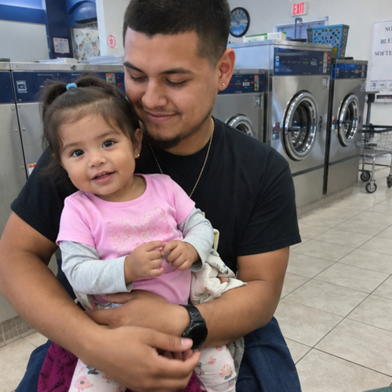
In memory of my best friend Patricia, who died of leukemia last September. We met in kindergarten in Indianapolis, in 1968. Fifty-six years....
View Story
Ninety-two counties from the Indiana Dunes on Lake Michigan to the Ohio River at Evansville. Lincoln’s boyhood ground in the south, the yard of bricks at Indianapolis, and limestone quarries that built the Empire State Building and the Pentagon. Map your crossroads on the Hoosier State map.
Reserve your place on the Indiana map and receive your personalized Certificate of Legacy — your name, your place, preserved for the next 250 years.
We'll save your progress. We won't share your email.
Appears on the map and on your Certificate of Legacy.
We'll email you a private link to add your story and photo anytime after payment. Add your subtitle, story, and photo below before payment.
Ready · 1024 × 1024
Pick the square that lives on the map
Founder price through July 11. It becomes $199 after — and stays there.
Please accept the terms to proceed with payment.
No account needed — we'll email a secure link after payment.
Your hex is reserved immediately.
★ Limited availability per state ★
Processing
Securing your place on the map…
Check your email to complete your story and finalize your place on the map.
Can't find it? Check your spam or junk folder — and add [email protected] to your contacts so future messages reach your inbox.
Limited availability per state