ID
MO-090
Featured
Cahokia rose across the river from present-day St. Louis around 1100 CE — the largest pre-Columbian city north of Mexico, twenty thousand people under an earthen pyramid that still stands. Missouri entered the Union in 1821 as a slave state paired with free Maine. Lewis and Clark launched up the Missouri in 1804. Mark Twain grew up in Hannibal on the Mississippi and gave America its voice. The Gateway Arch was completed in 1965 as a monument to expansion — which means, as much else does, to what expansion cost.
Missouri straddles the Missouri River in its center, the Mississippi on its eastern border, and the Ozark Plateau across its south. Its 114 counties and independent St. Louis city span terrain from flat northern plains to rugged southern highlands.
Begin with the territory that calls to you — your homeland, a frontier you love, or simply somewhere your story belongs.
Each hex is a sovereign coordinate. Pick a coastline, a valley, a city block — anywhere on the grid that resonates with your roots or your dream.
A photograph, a paragraph, a name. Your hex becomes a permanent thread in the larger national tapestry — the 250-year-old story of America, continued.
Your inscription becomes a permanent thread in the American story — and a keepsake you can print, frame, and hold.
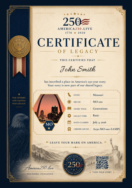
Your Commemorative Certificate
Print it. Frame it. Pass it down.
High-resolution digital certificate, custom to your state, delivered the moment your inscription is complete.
Digital Hex
Living Legacy
Your Inscription
$99 one-time · yours forever
Founder price, held through July 11. $199 afterward — and it stays there.
The Mississippian city of Cahokia, just across the river from present-day St. Louis, was the largest pre-Columbian city north of Mexico — home to 20,000 people at its peak around 1100 CE. Long after Cahokia’s decline, Missouri’s river valleys were home to the Osage, Missouri, and Shawnee nations when French explorers Jacques Marquette and Louis Jolliet first mapped the Mississippi confluence in 1673.
French settlers established Ste. Genevieve around 1735 and St. Louis in 1764, making Missouri the commercial hub of the vast Louisiana territory. The Louisiana Purchase of 1803 transferred the territory to the United States, and in May 1804, Meriwether Lewis and William Clark launched their Corps of Discovery from Camp Dubois across the river, paddling up the Missouri toward the Pacific. The expedition made St. Louis the literal starting point of American westward expansion.
Missouri entered the Union on August 10, 1821 as the twenty-fourth state, after the Missouri Compromise allowed it to enter as a slave state paired with free Maine. The compromise held the Union together for three decades but made Missouri a fault line — neither fully Southern nor fully Northern. When the Civil War came, Missouri fought itself: a pro-Confederate governor fled to Arkansas while a Unionist government took power, and guerrilla violence between “Jayhawkers” and “Bushwhackers” ravaged the border counties throughout the war.
After the war, St. Louis briefly rivaled Chicago as the nation’s second city. The 1904 World’s Fair drew 20 million visitors, introduced the world to the ice cream cone and iced tea, and celebrated the centennial of the Louisiana Purchase. Hannibal on the Mississippi produced Samuel Clemens — Mark Twain — whose novels of boyhood on the river became the country’s most beloved national literature. Kansas City grew into a jazz capital and barbecue capital, its own distinct identity rooted in the stockyards and the blues clubs of 18th & Vine.
Today Missouri is a state of contrasts: St. Louis and Kansas City anchor opposite ends with urban complexity, while vast stretches of the Ozarks and the northern plains remain rural, agricultural, and resistant to change. The Gateway Arch — completed in 1965 — rises 630 feet above the St. Louis riverfront as the nation’s tallest monument, a steel catenary curve that frames the west in every photograph and reminds everyone who built it that Missouri once meant the edge of the known world.
French explorers map the Mississippi-Missouri confluence, the first Europeans to document what will become Missouri’s geographic heart.
Pierre Laclède and Auguste Chouteau establish a fur-trading post on the Mississippi bluff. Within decades it is the commercial capital of the Louisiana territory.
The Corps of Discovery launches from Camp Dubois opposite St. Louis, paddling up the Missouri River toward the Pacific. Missouri is the literal starting line of American westward expansion.
Missouri enters the Union as the twenty-fourth state under the Missouri Compromise — a slave state balanced against free Maine, a bargain that defers but does not prevent the Civil War.
Dred Scott files suit for his freedom in a St. Louis courthouse. His case reaches the Supreme Court in 1857, whose ruling accelerates the nation toward war.
The Pony Express launches from St. Joseph, Missouri — the westernmost railhead — carrying mail to Sacramento in ten days across 1,900 miles of open country.
St. Louis hosts the Louisiana Purchase Exposition, drawing 20 million visitors. The ice cream cone and iced tea are popularized here. The city briefly holds itself equal to any in the world.
Charles Lindbergh, a St. Louis airmail pilot backed by St. Louis businessmen, flies nonstop from New York to Paris. His plane is named the Spirit of St. Louis.
Harry Truman of Independence, Missouri, becomes vice president. Within months of taking office, he will make the decision to use atomic weapons — the most consequential single act of any 20th-century president.
Eero Saarinen’s 630-foot stainless steel arch is completed on the St. Louis riverfront — the nation’s tallest monument, a parabola of ambition above the place where the West began.
Real Missouri people who have placed their names — and their stories — into the hex grid. Each square mile, a chapter.

Nestled in the Missouri Ozarks, Webster County has a rich history shaped by pioneers, farmers, and community builders. From its founding in...
View Story
DR. J.D. GEEEducator • Leader • Lifelong Learner • Community Servant Born in Frontenac, Kansas and rooted in the values of service, persever...
View StoryMy daughter Emma was born on October 14, 2014, at thirty-one weeks gestation, weighing two pounds and eleven ounces. She was diagnosed in th...
View StoryMy family has owned a small farm outside St. Louis since 1907. Four generations have worked that land — corn, wheat, soybeans, depending on....
View StoryCame to America in 1987 from the Philippines with my mother and younger brother. We had eight hundred dollars and a phone number for a cousi...
View Story
From the Cahokia mounds across from St. Louis to the Ozark hollows, from Mark Twain’s Hannibal to Harry Truman’s Independence — one hundred and fourteen counties of the state that sat at the seam of America, sent the explorers west, and remembered everything the rivers carried. Show me yours.
Reserve your place on the Missouri map and receive your personalized Certificate of Legacy — your name, your place, preserved for the next 250 years.
We'll save your progress. We won't share your email.
Appears on the map and on your Certificate of Legacy.
We'll email you a private link to add your story and photo anytime after payment. Add your subtitle, story, and photo below before payment.
Ready · 1024 × 1024
Pick the square that lives on the map
Founder price through July 11. It becomes $199 after — and stays there.
Please accept the terms to proceed with payment.
No account needed — we'll email a secure link after payment.
Your hex is reserved immediately.
★ Limited availability per state ★
Processing
Securing your place on the map…
Check your email to complete your story and finalize your place on the map.
Can't find it? Check your spam or junk folder — and add [email protected] to your contacts so future messages reach your inbox.
Limited availability per state