
MD-210
Featured
Maryland was founded in 1634 as a Catholic haven in a Protestant England — a tolerant experiment that preceded the First Amendment by 150 years. The Chesapeake Bay made the colony rich. Frederick Douglass was born enslaved on the Eastern Shore in 1818 and escaped to become the conscience of abolition. In September 1814, Francis Scott Key watched Fort McHenry’s flag fly through a 25-hour British bombardment and wrote the lines that became the anthem. Antietam absorbed 23,000 casualties in twelve hours in 1862 — the bloodiest single day in American history.
Maryland’s 23 counties and Baltimore City stretch from Garrett County’s Appalachian peaks in the west across the Piedmont and Chesapeake Bay tidewater to Ocean City’s barrier island on the Atlantic coast.
Begin with the territory that calls to you — your homeland, a frontier you love, or simply somewhere your story belongs.
Each hex is a sovereign coordinate. Pick a coastline, a valley, a city block — anywhere on the grid that resonates with your roots or your dream.
A photograph, a paragraph, a name. Your hex becomes a permanent thread in the larger national tapestry — the 250-year-old story of America, continued.
Your inscription becomes a permanent thread in the American story — and a keepsake you can print, frame, and hold.
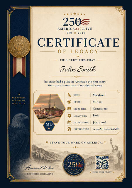
Your Commemorative Certificate
Print it. Frame it. Pass it down.
High-resolution digital certificate, custom to your state, delivered the moment your inscription is complete.
Digital Hex
Living Legacy
Your Inscription
$99 one-time · yours forever
Founder price, held through July 11. $199 afterward — and it stays there.
Maryland was founded as a haven for Catholics in a Protestant England — a tolerant experiment that preceded the First Amendment by 150 years. Lord Baltimore’s 1634 charter established a proprietary colony where religious difference was legally protected under the Act Concerning Religion of 1649. That Maryland promptly developed a plantation economy built on enslaved labor while championing religious tolerance captures the contradiction that ran through the state’s entire history: broad ideals, narrow practice.
The Chesapeake Bay made Maryland. Its 11,684 miles of tidal shoreline shaped everything — the tobacco economy of the colonial era, the oyster and crab harvests of the 19th century, the shipbuilding and trade that made Baltimore one of America’s great ports. The Bay’s tributaries reached deep into the interior, and the watermen who worked its waters developed a culture as distinctive as any in America: skipjacks, crab pots, deadrise workboats, and an intimate knowledge of tides that passed from father to son.
Fort McHenry gave the nation its anthem. In September 1814, a British fleet bombarded the fort at the entrance to Baltimore Harbor for 25 hours. Francis Scott Key, watching from a British ship where he was negotiating a prisoner exchange, saw the American flag still flying at dawn and wrote the poem that became “The Star-Spangled Banner.” The original flag — 30 by 42 feet — is preserved at the Smithsonian. The fort still stands on its Locust Point peninsula.
Maryland’s Civil War position was as fraught as any state’s. It was a slave state that stayed in the Union — partly by the Lincoln administration’s willingness to arrest the state legislature before it could vote on secession. Confederate sympathies ran deep in the Eastern Shore and southern Maryland; Union sentiment dominated the north and west. The bloodiest single day of the war, Antietam, was fought on Maryland soil in September 1862. Maryland supplied soldiers to both sides.
Today Maryland is defined by its relationship to Washington, D.C. Montgomery and Prince George’s Counties are essentially extensions of the federal city, housing hundreds of thousands of government workers, contractors, and their families. The National Institutes of Health, the National Security Agency, and NASA’s Goddard Space Flight Center all sit in Maryland. Yet the Eastern Shore remains one of the most rural and traditional landscapes on the East Coast, where skipjack races and blue crab season still set the calendar.
King Charles I grants Cecil Calvert, Lord Baltimore, a charter for the Maryland colony as a haven for English Catholics.
Maryland passes the Act Concerning Religion, one of the first laws in the world mandating religious tolerance.
Baltimore Town is established at the mouth of the Patapsco River, growing into one of the great port cities of colonial America.
Maryland ratifies the Constitution as the seventh state on April 28.
Francis Scott Key writes “The Star-Spangled Banner” after watching Fort McHenry withstand a British bombardment during the War of 1812.
The Baltimore and Ohio Railroad begins steam locomotive service — the first railroad to offer regular scheduled steam service in America.
The bloodiest single day in American military history unfolds near Sharpsburg; 22,700 casualties in one day stop Lee’s first invasion of the North.
Johns Hopkins University opens in Baltimore as America’s first research university, transforming American higher education.
The University of Maryland begins integration before Brown v. Board; Thurgood Marshall, an NAACP lawyer from Baltimore, argues the landmark case.
Oriole Park at Camden Yards opens in Baltimore, launching a nationwide movement of retro-style ballparks that transforms baseball stadium design.
Real Maryland people who have placed their names — and their stories — into the hex grid. Each square mile, a chapter.
Married 52 years next month. Built our whole life right here in Maryland. Thank you for every single one of those days.
View StoryMy family has called Maryland home for five generations. My great-great-grandfather Anders arrived from Sweden in 1887 with seventeen dollar...
View StoryMy great-grandfather Henrik arrived from Norway in 1898. He worked the railroads through Maryland and saved for sixteen years before he coul...
View Story
My father was nineteen years old when he landed in Korea in November of 1950. He was a corporal in the Second Infantry Division. He was at t...
View StoryThis is for the small towns of Maryland. The ones nobody writes songs about. The ones that raised us anyway.
View Story
Twenty-three counties and an independent city, from the Allegheny ridges to the Atlantic. Fort McHenry’s flag, Antietam’s twelve hours, the Chesapeake’s eleven thousand miles of shoreline, and the Naval Academy at Annapolis. Maryland holds more American consequence per square mile than almost any state. Hoist your banner.
Reserve your place on the Maryland map and receive your personalized Certificate of Legacy — your name, your place, preserved for the next 250 years.
We'll save your progress. We won't share your email.
Appears on the map and on your Certificate of Legacy.
We'll email you a private link to add your story and photo anytime after payment. Add your subtitle, story, and photo below before payment.
Ready · 1024 × 1024
Pick the square that lives on the map
Founder price through July 11. It becomes $199 after — and stays there.
Please accept the terms to proceed with payment.
No account needed — we'll email a secure link after payment.
Your hex is reserved immediately.
★ Limited availability per state ★
Processing
Securing your place on the map…
Check your email to complete your story and finalize your place on the map.
Can't find it? Check your spam or junk folder — and add [email protected] to your contacts so future messages reach your inbox.
Limited availability per state